
Digital mapping for smarter
environmental monitoring and action
e2 supports land workers to power environmental intelligence at scale
-
We provide a toolset that reduces burdens and unlocks opportunities for teams working in environmental protection, conservation and agriculture.
What we do
-
A full-stack of accessible technical tools such as databases, APIs, workflows and geospatial data visualisation that make it easier to work with and present data.
How we do it
-
So the benefits of stewardship are felt at source, we support data-driven and financial agency at a grassroots level.
Why we do it
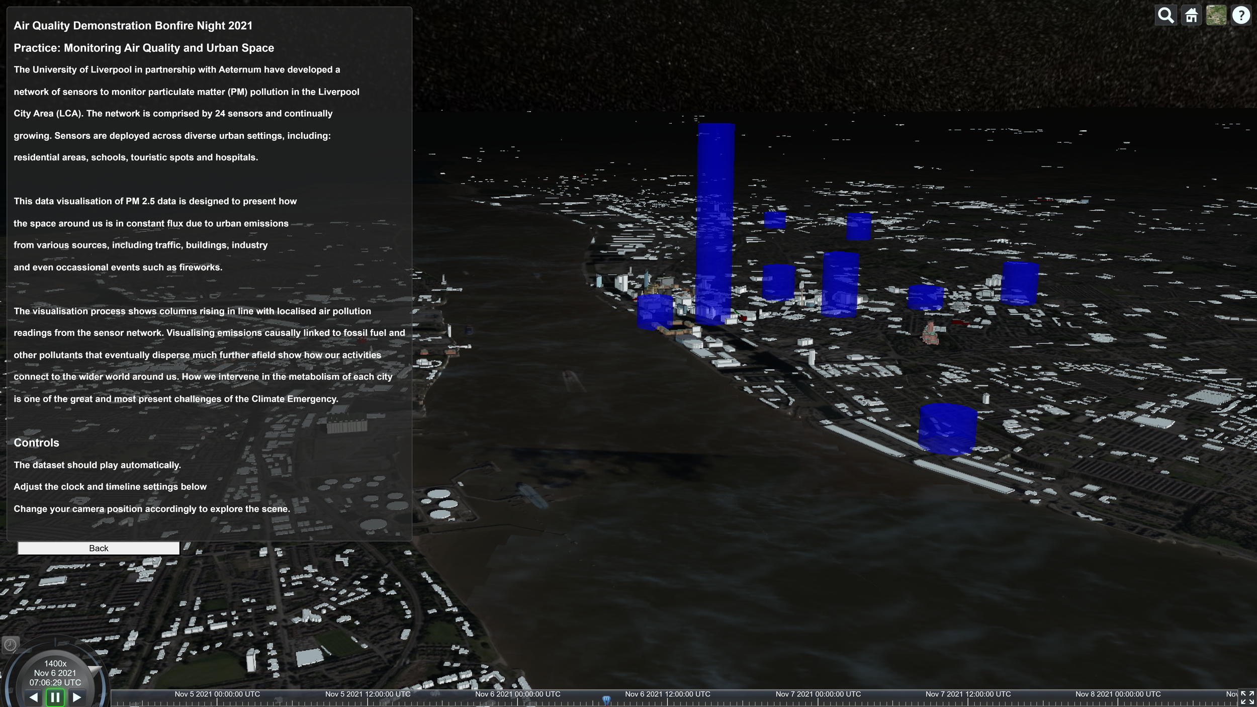
Obtain more value from project data. Load and manage LiDAR, sensor, satellite, GIS and mobile field notes into one interoperable database.
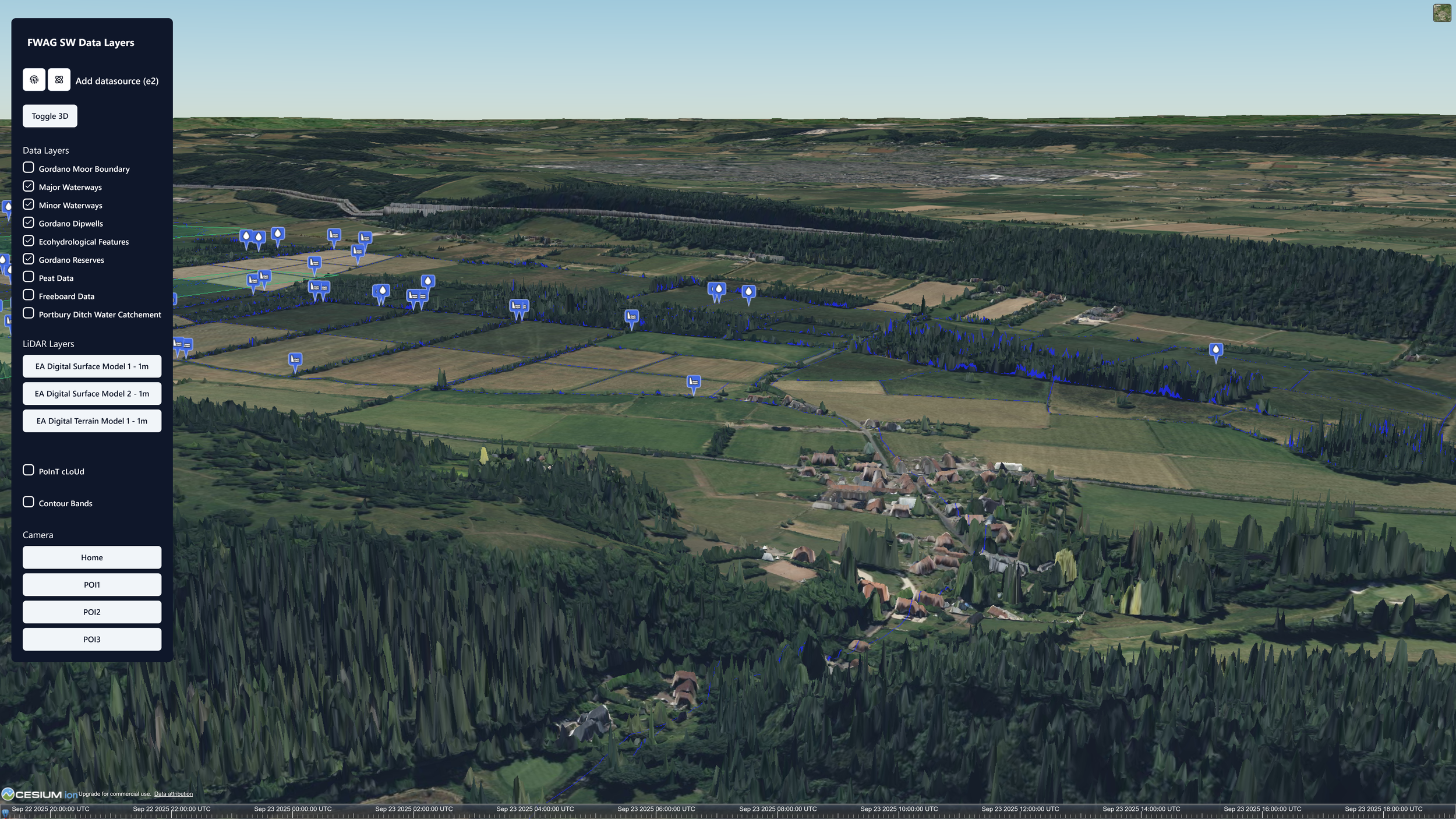
Insights You Never Had
-
Bring in any data source your require and run flexible queries across heterogenous datapoints - we ensure that your data is high-availability and that you are able to create and share informative visualizations on request to your partners.
-
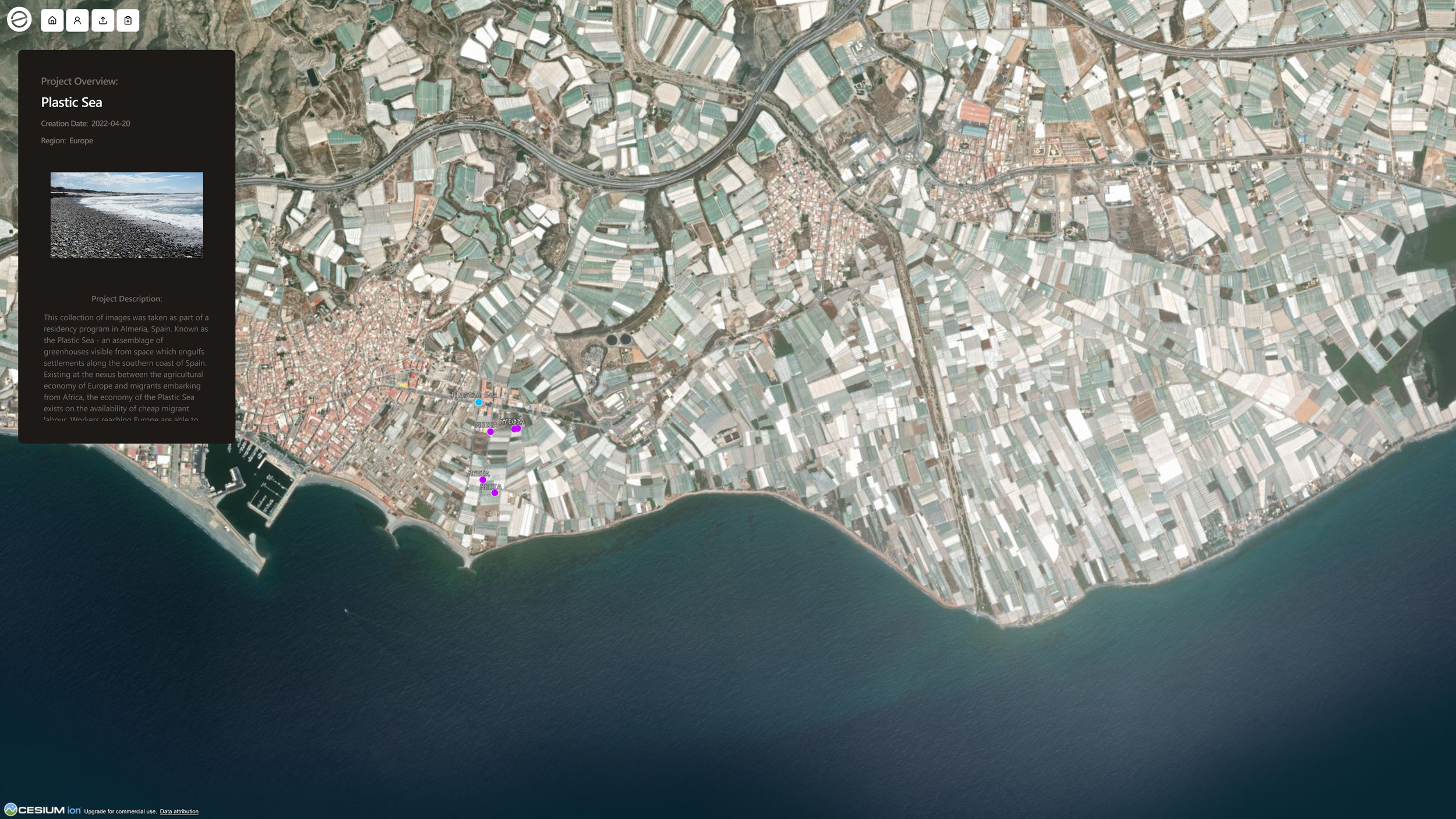
Manage and visualize data from various sources (sensors, satellites, smartphone media). You can monitor and verify the world around you with accurate geolocated data and when ready publish your stories to the world.
User Friendly
-
Create interoperable data schemas for long-term project monitoring and simplify the data management process for non-technical users
-
Reach verifiers, funders and stakeholders with less effort. Easily add fact-checked data sources and seek support from reputable IoT, LiDAR and Earth Observation data providers.
Flexible Data Collection
-
Your Land and its Stewards Own its Memory. Your context. Your insights. Your value.
If you are in it for the long-term our platform will pay you back in ease of use and intelligence.
-
We are mission and asset locked and tier pricing models to make our services affordable based on means and location